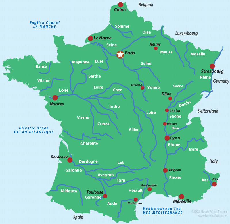
Map of the major rivers in France
The following map of France shows the main rivers flowing in and through the country. The major rivers, such as the Seine, the Loire and the Rhone, are the most well-known, with the Loire being the longest.

View a more detailed map of the rivers and canals in France's Inland waterways map.
Are you planning to cruise in France? Luxury hotel barges and license-free self-drive rental boats of different styles, including cruisers and penitentes, are perfect for holidays with family and friends.
The rivers and canals connect to provide a vast network of inland waterways, perfect for cruising holidays.
Learn how the inland waterways connect all the rivers and canals, which barges still use to transport cargo throughout the country. Many of the same rivers and canals have also adapted to become prime destinations for vacations and holidays. Hotel barges and self-drive rental boats cruise along many rivers and canals.
Information and maps of the waterways, rivers and canals
The listings below provide more specific maps and localised details about France's rivers and canals. The maps can help you plan your holiday itinerary for a houseboat cruise, barge trip, or self-drive boat vacation, but please don't use them for navigational purposes.
All the rivers and canals, with facts, figures, dates and much more.
Alsace rivers and canals
- The Rhine
- The Moselle
Burgundy rivers and canals
Southern France, Provence, Midi
- Canal du Midi
- Camargue
- Garonne
- River Lot
- River Rhône
Western France
- Britanny rivers
- Loire Valley
- River Charente
©Copyright 2010 - 2026 Hotels Afloat France
v3.21