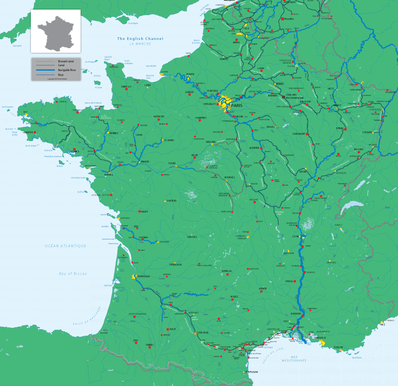
The navigable inland waterways of France
A map showing the major rivers, canals and navigable inland waterways
The French inland waterway network allows barges and boats to cruise from the English Channel and countries to the north and northeast of France, southwards to the Mediterranean Sea. The Atlantic is connected to the Mediterranean via the Garonne and Midi Canals.
Disused canals are shown as grey dots. Functional canals are dark blue dots. Navigable rivers are displayed as thick, light blue lines.

This map may help you plan your canal boat and barge holidays in France. If you need more information or have any questions about river and canal cruising, please browse our selection of hotel charter barges and self-drive canal boat rentals.
©Copyright 2010 - 2026 Hotels Afloat France
v3.21