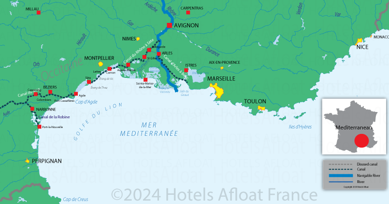
Map of the French Mediterranean coast
A map showing the Mediterranean Sea's main rivers, canals, towns, ports and estuaries.
The river Saône joins the Rhône in the city of Lyon. The Rhône then flows south to the Mediterranean Sea.
Just before Arles, the Canal du Rhone to Sete follows the coastline to the west, passing through the Etang de Vic and Thau before connecting to the Canal du Midi.
The Canal du Midi begins at Marseillan near Agde and heads westward to join the le Canal latéral à la Garonne at Argens-Minervois. It provides a route from the Mediterranean Sea to the Atlantic coast via Bordeaux. The two canals are called "Le canal des Deux-Mers" and total 434 kilometres in distance.

There is a good choice of hotel barges and self-drive boat rentals available in this part of France. The climate is very agreeable almost all year round.
©Copyright 2010 - 2026 Hotels Afloat France
v3.21